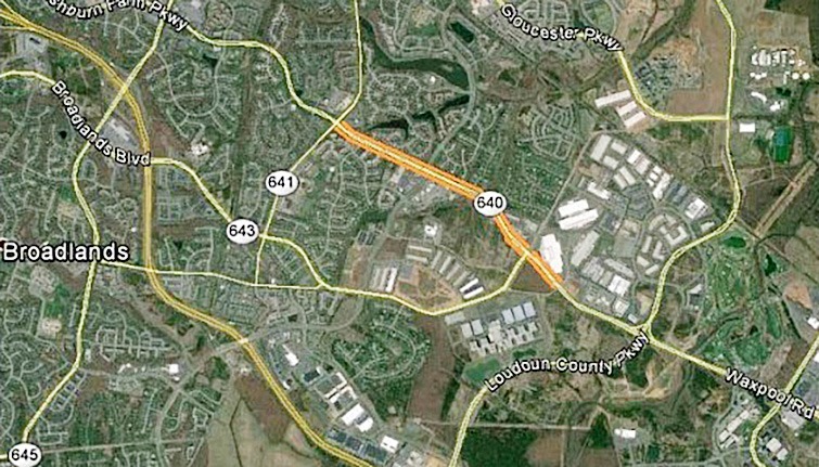
This project is located at the intersection of Farmwell Road and Waxpool Road in Loudoun County, Virginia. A highly traveled roadway in one of Loudoun County’s higher density areas. The area has more Data Centers within a 10-mile radius (128), than any other region in the U.S. The project supported the planning, design, right-of-way acquisition, and construction of intersection improvements along the Loudoun County Parkway and Waxpool Road corridor.
As a subcontractor, SAM’s scope of services was to provide the depictions of utilities including at the appropriate Quality Level (B, C or D) onto the design plans in the preliminary engineering phase. As the design progressed, “Quality Level A” utility data at specific locations was required to resolve conflicts between the roadway design and existing utilities. SAM performed utility records research, designating, locating, survey, quality assurance, professional review, and mapping in accordance with ASCE Standard CI/ASCE 38-02, Standard Guideline for the Collection and Depiction of Existing Subsurface Utility Data, the subsurface utility engineering profession (SUE), and pertinent FHWA and AASHTO documents.
Sanitary Sewers were located, opened and inverts surveyed. Pipe size and shape, material type were determined along with pipe direction at the manholes (buried) and catch basin structures onto the provided plans. Flow lines were depicted as running straight between structures unless record information or site conditions indicated otherwise. The rim and invert elevations were determined at the structures.
The work was located along Farmwell Road and Waxpool Road. Linear length of the project was approximately 5,000 linear feet. In 2015, SAM performed Quality Level “B” mapping of 102,862 linear feet of underground utilities at Quality Level “B”. SAM also excavated and documented “Quality Level A” information at 80 test hole locations. The test holes were produced using non-destructive “air-vacuum” excavation, surveyed to applicable tolerances, backfilled in compacted 6″ lifts and permanently patched to VDOT specifications. The test holes documented the precise horizontal and vertical location of the utilities at points of potential conflict with the design.


